Google Maps Restores Multiple Destination Function

The redesign of Google Maps earlier this year left out one of its most useful features – the ability to create a map with multiple destinations.
But Google has now revealed it is now returning the capability and adding two other useful tools in its latest update.
User Feedback
The changes, which came largely due to user feedback about the new Google Maps services in the last three months, were announced by Florian Goerisch, product manager for Google Maps, in an 9 October post on the Google Lat Long Blog. “Based on your input, we’re pleased to announce one of your most requested features – directions for multiple destinations – will begin rolling out today,” wrote Goerisch.
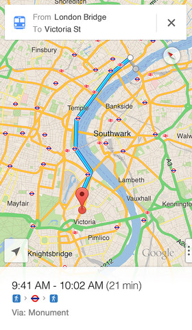 The multiple destination capability that was in earlier versions of Google Maps allowed users to plan a trip from point A to point B, then add a point C in as well, making it a fabulous tool for planning a trip to a string of destinations. It helped users plan distances, routes and stops along the way, and its disappearance from the reworked Google Maps earlier this summer was panned by many users on Google+ comment pages.
The resurfacing of the feature is bound to be welcomed by users.
“Whether you’re running weekend errands or planning a cross-country tour, you can plot multiple destinations for your trip with ease – now available for driving, walking and biking directions,” wrote Goerisch. “Once you’ve chosen a starting point, click ‘+’ and add stops to your route by typing in the search box or clicking on the map.”
Users can also use the feature to find the best route to museums, historic squares and other attractions by dragging and dropping their destinations on the map in any order, he wrote. “And if you’re curious before you go, the Views carousel, located in the bottom right corner, is a great way to preview Street View, Photo Tours, and other imagery.”
Also added to Google Maps in the latest updates are useful capabilities that allow users to find flight, hotel and restaurant reservations faster while inside the Maps application. “Just search for your departing airport or dining destination, and we’ll instantly show your upcoming plans,” Goerisch wrote. “Having all your stuff in one place makes it easier to manage your appointment details and plan your commute. This info is available when you’re signed into Google, and only you can see it.”
Upcoming Events
That information can then be accessed by users on their Android phones or iPhones, where they will be able to see their recent search histories on the Google Maps app. So far, this feature is presently rolling out to Maps users in the United States and is available in English only, wrote Goerisch.
The other new feature for Google Maps is the ability to now find upcoming events on a card within the service, wrote Goerisch. “Search for Radio City Music Hall, the O2 Arena, or your favourite local performance venues, and click on the Upcoming Events card to see a schedule of concerts, sports matches, and other events happening near you. Or if you’re new to an area, start with ‘music venues.'”
The new features are part of a string of improvements that Google is always working on to expand its Google Maps offerings.
Train Service
 Earlier in October, Google and Amtrak unveiled a new service that uses Google Maps to offer Amtrak customers their first-ever real-time, interactive train locator maps for mobile users so they can check train arrival and departure times on the run. So far, the early version of the maps Website is aimed at Android and iPad tablet users because of the larger screens on those devices, but smartphone-based versions are expected in the future.
In July, Google Maps unveiled a new maps layer for developers so that they can better integrate their data with images in Google Maps. The innovative DynamicMapsEngineLayer gives developers the abilities to perform client-side rendering of vector data, allowing developers to dynamically restyle the vector layer in response to user interactions like hover and click, according to the company. The new maps layer makes it easier for developers to visualize and interact with data hosted in Google Maps Engine.
In June, Google for the first time released its Google Maps Engine API to developers so they can build consumer and business applications that incorporate the features and flexibility of Google Maps. With the Maps API, developers can now use Google’s cloud infrastructure to add their data on top of a Google Map and share that custom mash-up with consumers, employees or other users. The API provides direct access to Maps Engine for reading and editing spatial data hosted in the cloud, according to Google.
Google Maps got a preview of its new look in May at the annual Google I/O Developers Conference, including a more interactive look and feel. The new Google Maps takes a novel approach to how people use online and mobile maps, gaining the ability to instantly respond to user inputs, making recommendations on places to visit and highlighting information that matters most during a map inquiry. The next generation of the Maps service essentially will create a map that is unique to each user and his or her needs, based on the input from the user.
Are you an expert on Google? Take our quiz!
Originally published on eWeek.


