Google Maps Utilises AI For Immersive View Tool

The use of AI by Google Maps utilised for launch of Immersive View tool, so users can preview their travel routes
Google Maps has expanded an existing feature and unveiled a few new ones that utilise artificial intelligence (AI) capabilities.
On Thursday Chris Phillips, VP and general manager of Google’s Geo (or geography, division) announced in a blog post that Google Maps now has an immersive view so drivers can preview their routes, as well as other AI features.
The previewing of routes may have helped Google negate a lawsuit last month, after it was sued when a father died when he drove off a collapsed bridge in the United States whilst following a route on Google Maps.
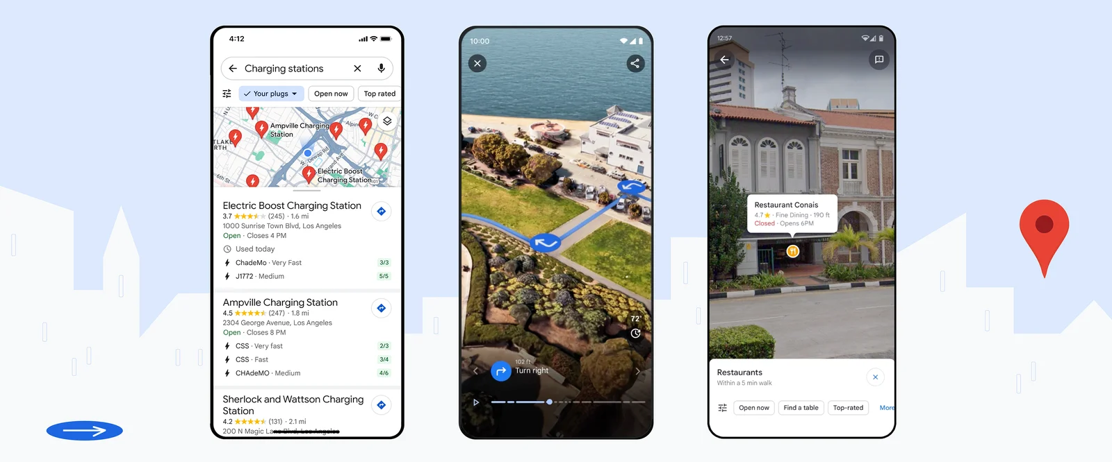
Image credit Google
Immersive View
Google had allegedly been informed the bridge had been collapsed for five years, but had failed to update its navigation system.
Now this week Google’s Chris Phillips has announced some new AI updates to Google Maps.
“Google Maps provides over 20 billion kilometers of directions every day. And with AI, we’re reimagining how you plan your trips before you go,” wrote Phillips. “At I/O this year, we announced Immersive View for routes, an entirely new way to preview every step of your journey – whether you’re driving, walking or cycling.”
“This week, Immersive View for routes starts rolling out in Amsterdam, Barcelona, Dublin, Florence, Las Vegas, London, Los Angeles, Miami, New York, Paris, San Francisco, San Jose, Seattle, Tokyo and Venice on Android and iOS,” wrote Phillips
Essentially, Immersive View allows a user to tap on the option, so they can see their route in a multidimensional view from start to finish. The user can thus prepare for each turn as if they were there with detailed, visual turn-by-turn directions, and use the time slider to plan when to head out based on helpful information, such as simulated traffic and weather conditions.
According to Phillips, this new feature “builds on our work for Immersive View for places, which uses AI to fuse together billions of Street View and aerial images so you can know what a restaurant or landmark is like before you go.”
Lens in Maps
In addition, Google Maps also makes it easier for a person to understand their surroundings once they get somewhere – such as when a user exits an underground train station and need to orient themself.
Lens in Maps (formerly called Search with Live View) uses AI and augmented reality to help the user when the Lens icon is tapped in the search bar, and the user then lift their phone to find information about nearby ATMs, transit stations, restaurants, coffee shops and stores.
Google Maps has now expanded this, with Lens in Maps coming to more than 50 new cities including Austin, Las Vegas, Rome, São Paulo and Taipei.
EV chargers
Another new feature allows for drivers of electric vehicles to avoid charging anxiety, by giving Android and iOS drivers the ability to see nearby charging station information.
This includes whether a charger is compatible with their vehicle and whether the available chargers are fast, medium, or slow to help the driver find the charging station that best meets their needs.
And given that roughly 25 percent of all chargers in the US are down (faulty) at any given time, the driver can also see when a charger was last used to help them avoid wasting time heading to a broken charger.