The use of big data in business has evolved significantly over the last few years, shifting from a focus on pure data collection to one of unlocking the power of this information.
This change has been driven by the likes of Business Intelligence (BI) platforms that provide an added layer of context and insight to help organisations make strategic decisions based on patterns and trends.
But things are now being taken a step further still with the growth of Operational Intelligence (OI) tools, which provide businesses with dynamic decision-making capabilities by combining multiple data sets from different sources.
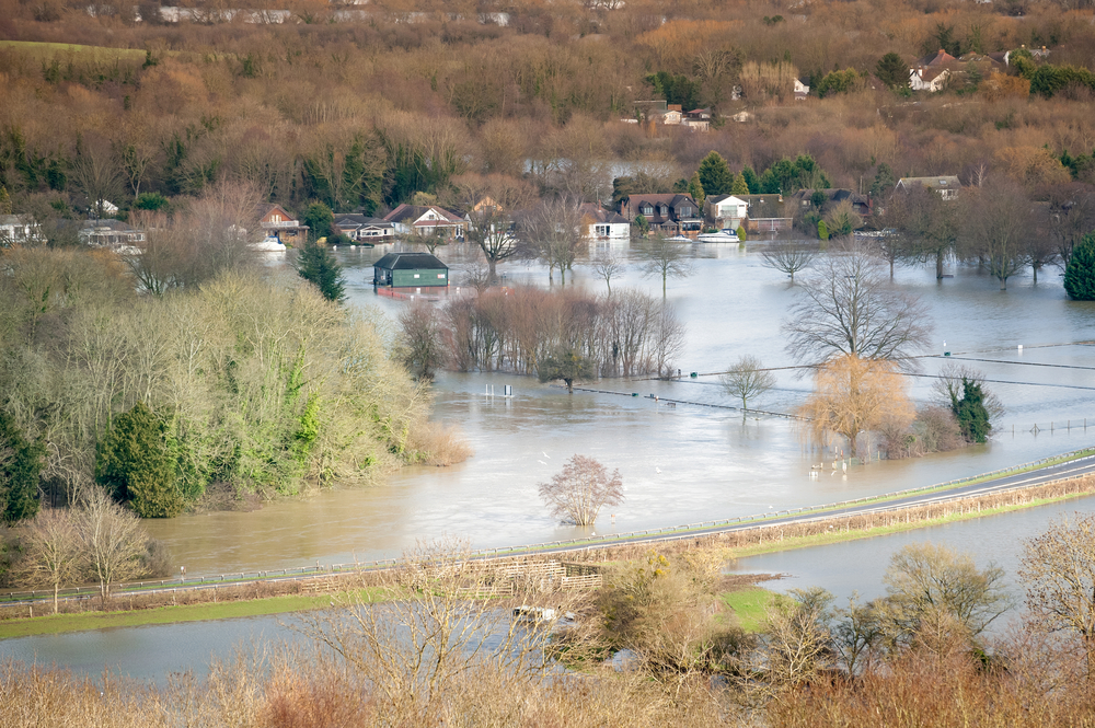
This is exactly what the UK government’s Environment Agency (EA) is doing, using Esri software to combine real-time data with mapping technology and historical information to respond to flooding incidents across the country.
“We’ve been doing a lot of work over the last year and a half looking at how we respond to major incidents,” said Nick Jones, senior advisor at the Environment Agency.
After the 2015 Cumbria floods, the agency realised there was a “huge opportunity for us to innovate and change the way we use technology,” so has gone about ‘digitising’ the three stages of its incident response lifecycle through the use of Geographic Information Systems (GIS).
The first stage is pre-incident, where the focus is on prediction and preparedness: “We’re using a lot of operational intelligence through spatial data from the Met Office to understand where flooding is likely to happen and then from that we can move our kit around the country,” Jones explained.
“We’ve got things like temporary barriers and pumps so we can move them strategically across the country and all that kit is now GPS tagged so we can see where it’s moving. It’s all about making sure we’ve got the resources where they need to be to respond before the incident takes place.”
The key factor here is the visibility data provides into the real-time locations of each piece of equipment, which is obviously essential knowledge to have when it comes to the second phase of actually responding to an incident.
Jones continued: “That’s about having the guys on the ground, talking to people, taking real-time information on mobile devices so they can feed back to our strategic incident rooms which sit around the country.”
The EA currently has 21 incident rooms across the country, which operate on three different tiers that feed into different levels of government all the way up to the Prime Minister and COBRA if it’s a nationwide incident.
“This real-time information from the field is really valuable at all those different levels so we can direct resources where they’re needed,” said Jones, also citing the information sharing that goes on with police and fire services.
“The key thing for us is it’s one version of the truth. So all of these different people are working from one data set essentially, where we’ve got thousands of people capturing data to go into one single source and then you’ve got people at different levels, in different locations all over the country all viewing that one data set.
“And they’ll have different views of that data as well. So the guys in the local teams will have a local area filter view and then the guys at COBRA will look at the national picture and will have key strategic information highlighted for them.
“It’s all about using real-time operational intelligence to know what’s going on, where and when and feeding that back to different teams”
Perhaps the most important aspect here is that field service employees are equipped with iPads and smartphones containing GIS software so they can input new data wherever they are, thus increasing the amount of information available to the incident response rooms in real time.
The final phase is post-incident, which is all about logging as much data about a specific flood as possible so that the information can be fed back into the EA’s historical archives and improve the predictive algorithms.
This can provide valuable insights such as where various pieces of equipment are likely to be needed at certain times of year, potentially saving precious days and hours in the event of a flood.
The common threat which weaves throughout this whole process is the importance of giving context to data.
Jones gave the example of integrating GPS data into cameras, so the agency can know exactly where each picture was taken: “Because we use a lot of pictures to historically map flood levels against properties, for example, if you don’t know exactly where that picture was taken it’s really hard to then put that into our archives for historic data.
“So by rolling out the new mobile technology that GPS-tags all the pictures and gives us a load of metadata, we can really enhance our data.”
Practical examples such as this can also aid the data added to live flood maps and enable the EA to communicate more effectively with members of the public via social media channels.
The Environment Agency provides a great example of the power of GIS data and highlights the value that can be gained from getting real-time insights out of data, rather than simply holding on to static information.
Tesla shareholders to be asked to reinstate Elon Musk's $56 billion pay package, days after…
Catching WhatsApp? Billionaire founder of Telegram claims encrypted platform will reach one billion users within…
Good news for Mark Zuckerberg as judge dismisses some claims in dozens of lawsuits alleging…
Consequences of Assembly Bill 886. Google begins removing California news websites from some search results
CEO Tim Cook during visit to Jakarta says Apple will look into building a manufacturing…
Introduction of digital services tax on tech firms will begin in 2024 Canadian government confirms,…